Town Centre Map 2024
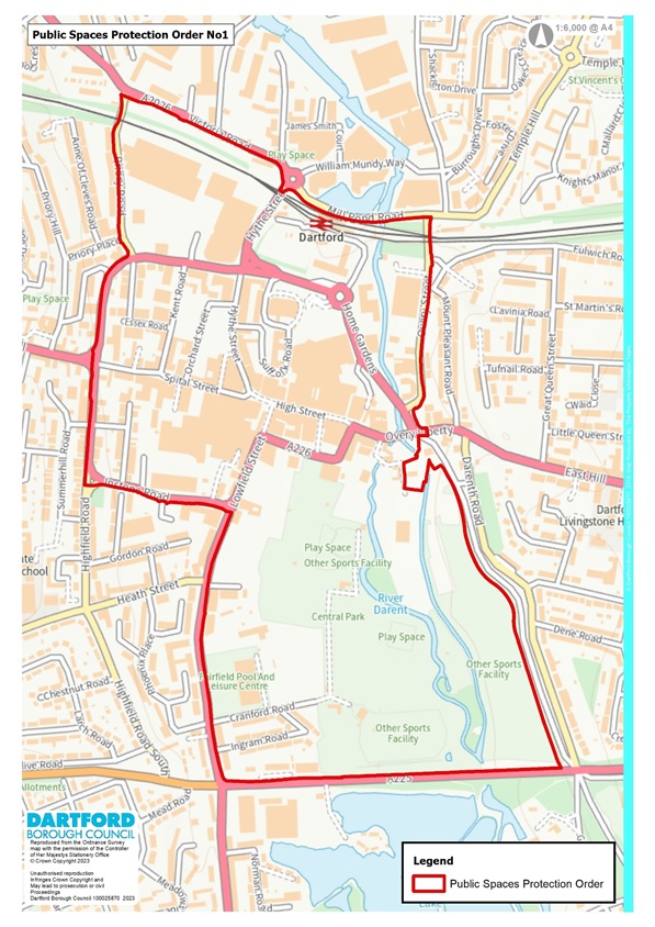
The land identified by the Map of Dartford Town Centre being the areas to which this Order applies includes the following;
Dartford Town Centre, including the former Westgate Multi-storey Car Park and Bullace Lane, Copperfields, Cranford Road, Essex Road, High Street, Highfield Road, Home Gardens, Hythe Street, Instone Road, Junction Road, Kent Road, Lower Hythe Street, Lowfield Street, Market Place, Market Street , Orchard Street, Overy Street, Priory Centre, Priory Road, Prospect Place, Providence Place , Spital Street, Spring Vale, St James's Place, Station Approach Road, Suffolk Road, Victoria Road, West Hill, Westgate Road, Woodin Close.
A copy of the Town Centre Map showing the areas covered by the Town Centre Order can be downloaded below: